#

Port Atapupu

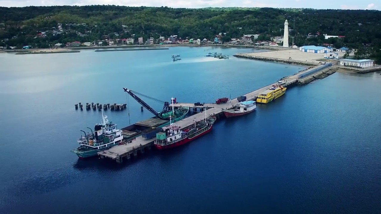
Special Terminal (TERSUS) Atapupu is a dedicated jetty facility located in Atapupu, Belu Regency, East Nusa Tenggara, operated by PT Pertamina Port & Logistics. The terminal handles the loading and unloading of fuel products (BBM) for the eastern Indonesia distribution network.

Location Atapupu, Kakuluk Mesak Sub-district, Belu Regency, East Nusa Tenggara, Indonesia
Terminal

Terminal Khusus (TERSUS) Atapupu

Berth

1 Jetty

Operation

12 Hours Operation

Vessel

Min/Max 0 – 3,500 DWT, Min/Max 0 – 95 m LOA

Timezone

UTC +08:00 

Overview

PT Pertamina Port & Logistics operates the Atapupu special terminal as a single-jetty fuel distribution point serving the Atapupu–Atambua region. The terminal is not subject to compulsory pilotage and operates 12 hours per day, with berth layout and navigational charts available to visiting vessels.

Facilities | Services

Facilities


Berth Infrastructure:

  • 1 Jetty Kolam/basin depth 6 m, Alur/channel depth 20 m, -mLWS


Navigation & Auxiliary Craft:

  • Aid to Navigation 4 units
  • Mooring boat 1 unit, 115 HP company-owned


Pollution Control:

  • Oil boom 710 meters
  • Oil skimmer 1 unit
  • Oil spill dispersant available
  • Oil dispersant pump 3 units
  • Oil sorbent available
  • Oil containment bag 1 unit


General / Support Facilities:

  • Fire-fighting facility Available

Services


Loading and unloading of petroleum fuel products:

  • Premium
  • Pertalite
  • Pertamax
  • Kerosene
  • Solar


Ship agency services:

  • Surat Laut
  • Surat Ukur
  • IAPP
  • IOPP
  • ISPP
  • SSCEC
  • Anti-Fouling
  • Water Ballast
  • Health Book
  • Crew documents

Vessel Information

  • Max Channel Depth 20 | Basin Depth 6 m 
  • Min/Max Vessel Capacity 0 – 3,500 DWT
  • Min/Max LOA 0 – 95 m
  • Jetty Type Jetty


Seabed Type:

  • Sand
  • Coral
  • Mud

Port Regulations

Radio Communication

Radio Communication Vessels must monitor VHF Channel 16 (156.800 MHz), Channel 19 (161.550/156.950 MHz) and Channel 9 (156.450 MHz). UHF radio is not available.

Tidal & Current Advisory

Maximum tidal range 2.6 m. Flood current 150°T at 0.3 knots; ebb current 285°T at 0.3 knots.

Map | Contact

Address:
Jl. Yos Sudarso KM.1, Jeniku, Kec. Kakuluk Mesak, Atapupu, Belu, East Nusa Tenggara, Indonesia
Phone:
+62 852-3224-1198
Operator:
PT Pertamina Port & Logistics – Port Atapupu
Jetty Capacity:

1 Jetty — Min/Max 0 – 3,500 DWT, Min/Max LOA 0 – 95 m

Information Post

#
Port Raha
  • Muna Island, Southeast Sulawesi, Indonesia.

#
Port Kupang
  • East Nusa Tenggara (NTT)
#
Port Jambi
  • Jambi